Lynsted Church of Saints Peter and Paul - Graveyard Monuments and Inscriptions
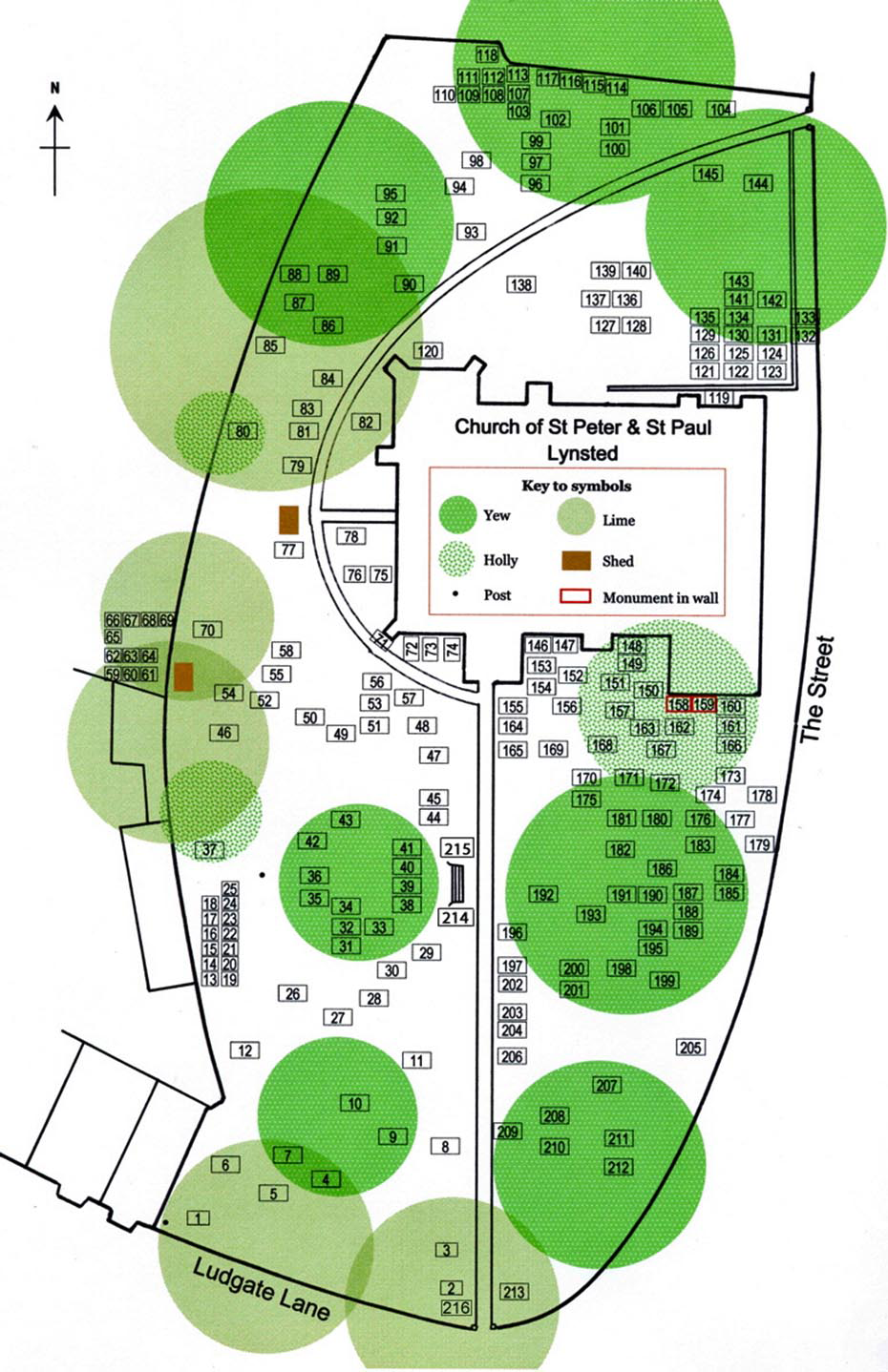
Graveyard Map
This map shows the location of each surveyed burial plot, ashes interment and memorial. The map complements the family names Data Cards (see right, second bullet-point). The sequence of numbers is broadly clockwise from the south gate on Ludgate Lane.
Each Data Card contains an image of the stone and interpretation of remaining evidence of inscription. Many stones are simple footstones with only initials on them. A large number of those footstones are clustered against the West and North churchyard walls.