Maps showing Lynsted, Greenstreet and Kingsdown
Lynsted, Kingsdown and Greenstreet appear throughout the mapped ages - but not always together nor in the right place! If you have any others please consider letting us copy them into this collection. It was not until the 1801 Ordnance Survey for Kent (with Napoleonic Wars firmly in mind) that the placing of towns and villages in relationship to eachother became more accurate. So, for example, in a 1742 map Sittingbourne sat between Teynham and Norton.
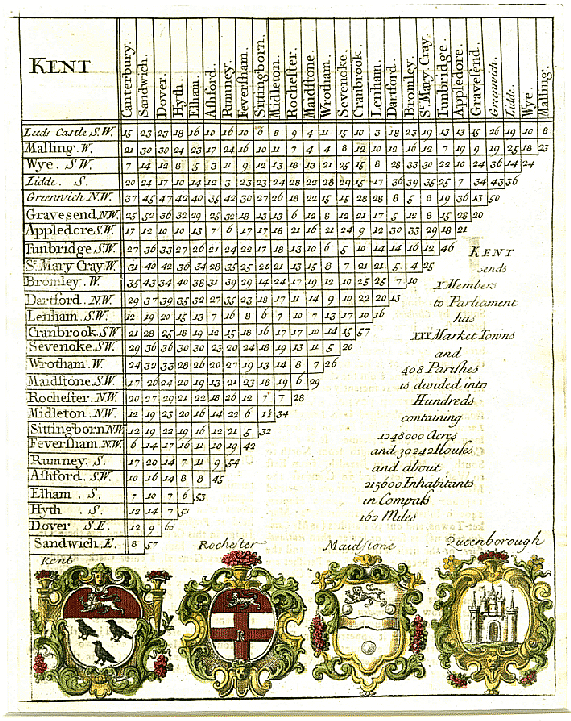
- 1701-22 Mileage Chart - placing Sittingbourne and Faversham in the context of Kent.
- 1742 Map detail - showing Sittingbourne, Faversham and Teynham. Map Marginalia: "KENT containing 2 Cities & 2 Boroughs sends 10 Members: & including 4 of the Cinque Ports, which sends 8 Barons to Parliament make in all 18 it has likewise 24 Market Towns, and 408 Parishes." The text goes on to describe the larger centres in terms of their Market Days, Fair Days, and members of parliament. Markets in Faversham were on Wednesday and Saturday; Sittingbourne has no mention.
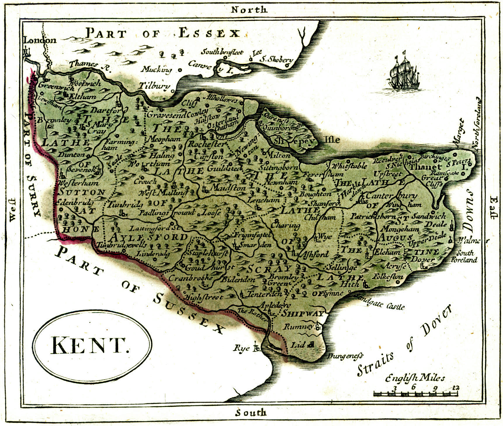
- 1767 Lathe of Scray - Map of the whole of Kent - Sittingbourne and Faversham showing.
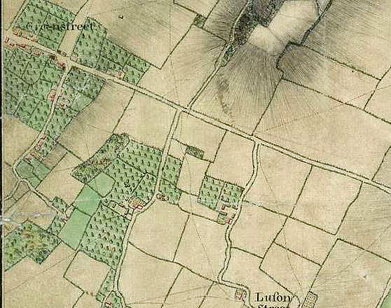
- 1797 Detail of Greenstreet Hill, Cellar Hill and Lewson Street.
- 1801 First Ordnance Survey Map - note there are two "Stones" and "Claxfield" is placed in Cellar Hill - so not foolproof, even if this was a massive improvement on all previous maps!
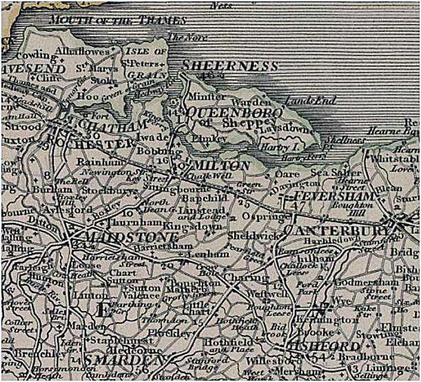
- 1806 C. Smith Map (detail) from map of Southeast England
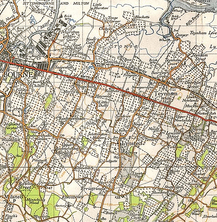
- 1940 Ordnance Survey Map - including Sittingbourne, Milsted, Norton and Teynham Street.
- 1945 Ordnance Survey Map - including Sittingbourne, Milsted and Teynham Street.
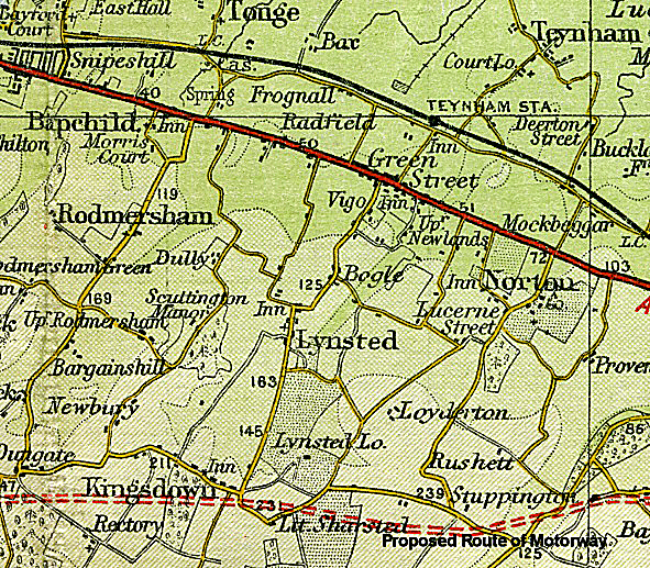
- 1959 Ordnance Survey - showing the proposed route of the new M2 Motorway.
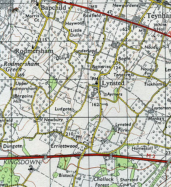
- 1964 1" map - curiously, the Parish of Kingsdown is shown but not the village/hamlet.